Waterhouses Locks 20 - 22
[Back to previous page - Waterhouses Aqueduct and Lock 19]
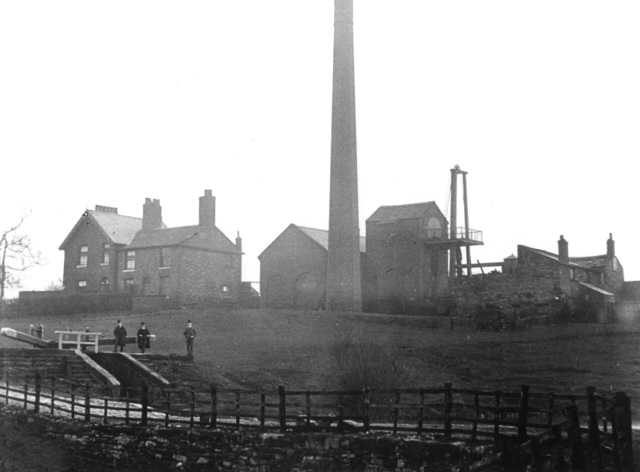
The pumping station and lock cottages next to Waterhouses Locks. The lower of the two staircase locks is on the left. (1920s?). [Photo: Garry Jones of Littlemoss]
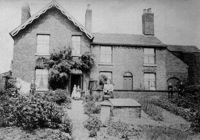
The cottages next to Waterhouses Locks were occupied by those who looked after the punping station and locks and their families. (1920s?). [Photo: Garry Jones of Littlemoss]
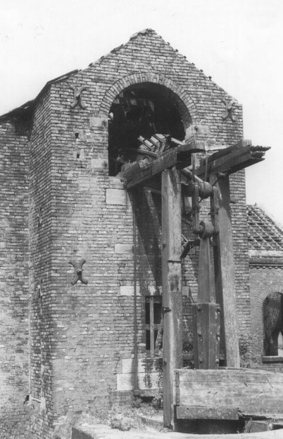
The pumping station in a derelict state (1940s). [Photo: Garry Jones of Littlemoss]
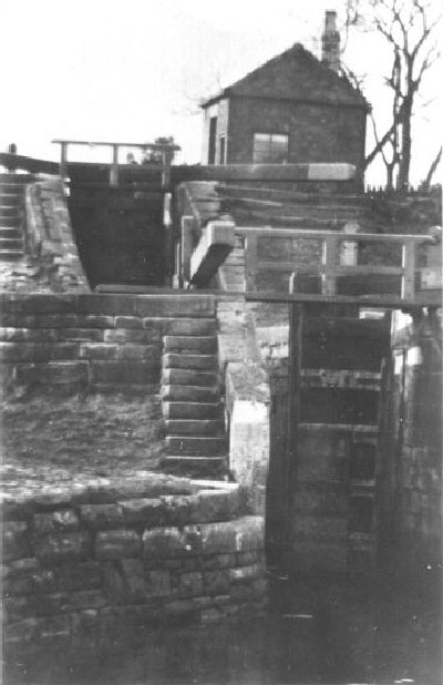
The staircase locks at Waterhouses, Daisy Nook (Ashton Canal Locks 20 and 21) (1940s).
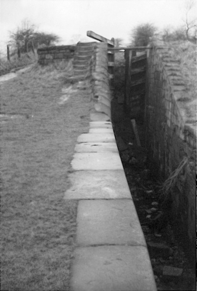
The staircase locks at Waterhouses, Daisy Nook (Ashton Canal Locks 20 and 21), showing the chamber of the lower of the two locks (1962). [Photo: Chris K. Potter Archive]
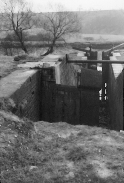
The staircase locks at Waterhouses, looking from the chamber of the upper lock, which has been partly infilled (1962). [Photo: Chris K. Potter Archive]
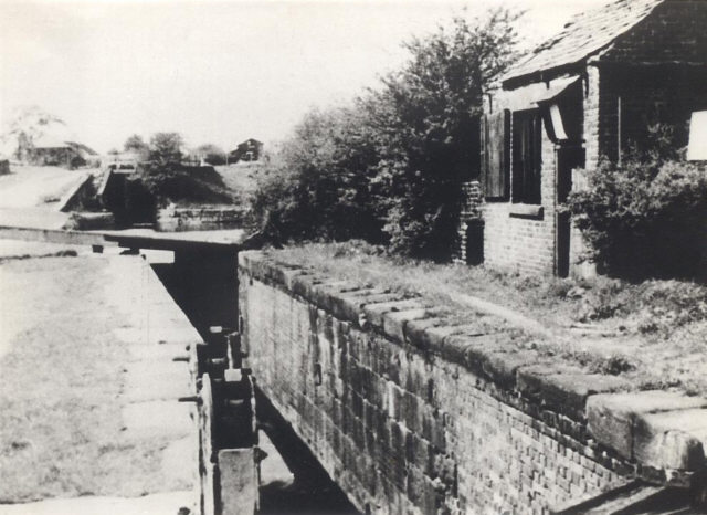
The upper chamber of the staircase locks, showing paddle gear and the brick hut alongside the lock (1950s). [Photo: Garry Jones of Littlemoss]
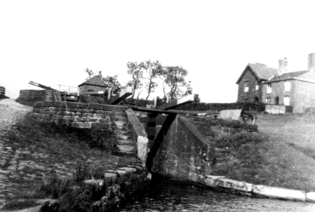
The staircase locks at Waterhouses [1940s].
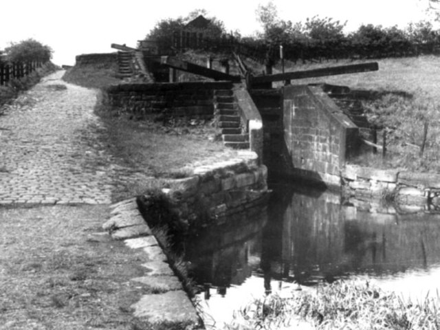
The staircase locks at Waterhouses [1950s].
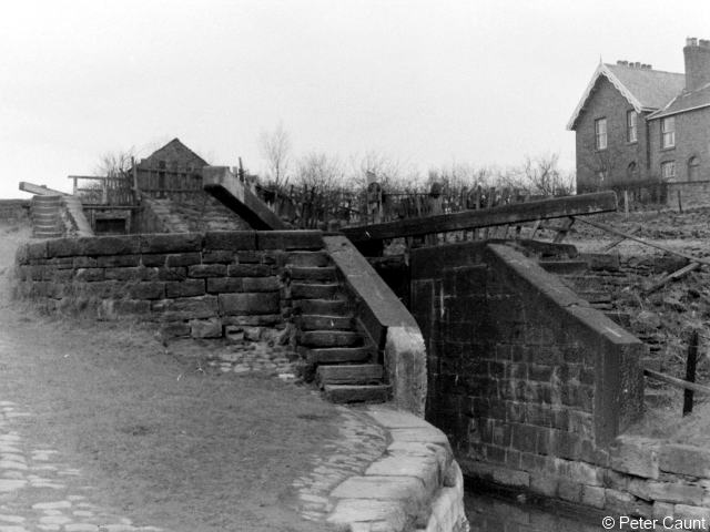
The staircase locks at Waterhouses [1960s]. [Photo: Peter Caunt]
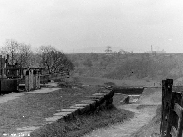
Looking down the staircase locks at Waterhouses [1960s]. [Photo: Peter Caunt]
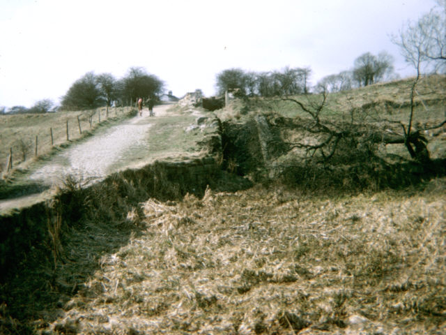
The staircase locks at Waterhouses [late 1960s]. [Photo: Stephen Desmond]
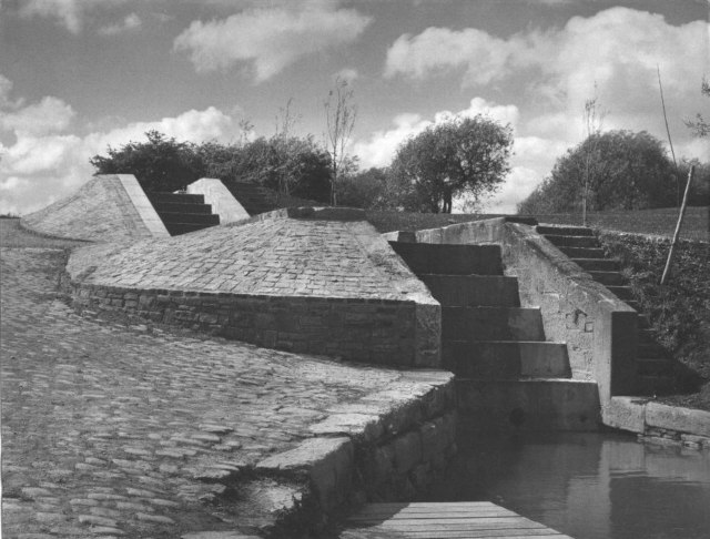
The staircase locks after the creation of the Country Park (1970s).
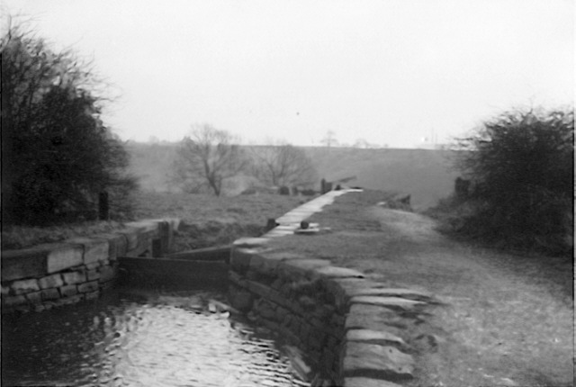
The partly-infilled upper lock of the staircase locks at Daisy Nook (1962). [Photo: Chris K. Potter Archive]
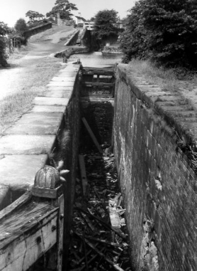
The higher of the two staircase locks at Waterhouses, looking towards Lock 22, with Sammy's Basin to the right (1960s). [Photo: Leonard Kaye courtesy Oldham Local Studies Library]
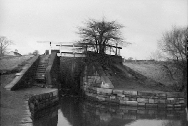
The top lock at Waterhouses, Daisy Nook - Lock 22 of the Ashton Canal. The bridge across the tail of the lock was fairly substantial as it gave access to the towpath of the Fairbottom Branch, which led off immediately above this lock (1962). [Photo: Chris K. Potter Archive]
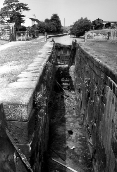
The top lock at Waterhouses, looking along the chamber from the lock tail bridge. The Fairbottom Branch leads off to the right just beyond (1960s). [Photo: Leonard Kaye courtesy Oldham Local Studies Library]
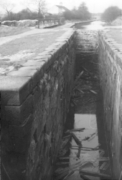
The top lock at Waterhouses, looking along the chamber from the lock tail bridge. The top gate has been replaced with a stone wall (1962).
[Photo: Chris K. Potter Archive]
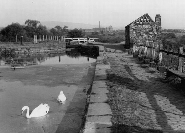
The top lock at Waterhouses. In the foreground is the spillway that takes surplus water straight down to the River Medlock, but it is dry as the water is seeping through the locks. A stone hut stands alongside the spillway (1950s). [Photo: Manchester Libraries]
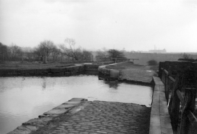
The top lock at Waterhouses. The stone hut has gone. The lock mouth has been bricked up and water now overflows via the spillway, so the wooden boards that crossed the spillway have been restored (1962). [Photo: Chris K. Potter Archive]
Go to next page: Pinch Farm and Crime Lake
[Back to previous page - Waterhouses Aqueduct and Lock 19]
[Back to: Photo Gallery Index Page]
Photos credited to Chris K. Potter Archive: these may be freely reproduced subject to acknowledgement of "Chris K. Potter Archive" as source.
Other photos may not be reproduced without permission of the photographer or collector.
