Woodhouses and Cutler Hill
[Back to previous page - Pinch Farm and Crime Lake]
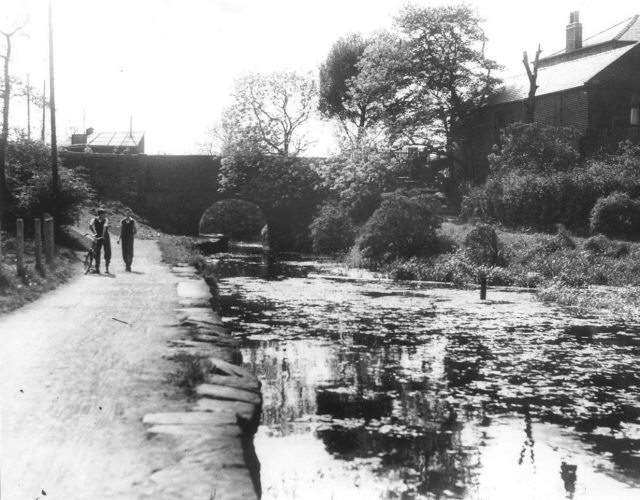
Crime Bridge and the canal leading from Crime Lake towards Cutler Hill (1950s). [Photo: Garry Jones of Littlemoss]
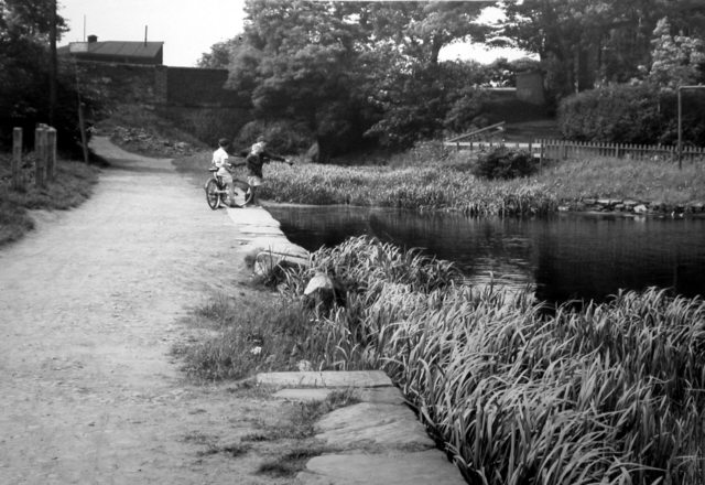
Crime Bridge and the canal leading from Crime Lake towards Cutler Hill (1960s). [Photo: Leonard Kaye courtesy Oldham Local Studies Library]
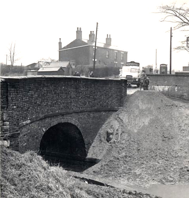
Crime Bridge in the process of being filled in for road widening (1960s). [Photo: Garry Jones of Littlemoss]
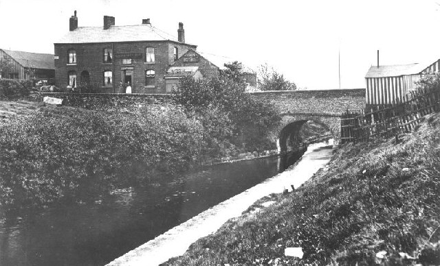
Crime Bridge and the Crime View pub, looking towards Crime Lake (1940s). [Photo: Garry Jones of Littlemoss]
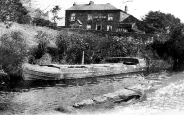
Work boat moored below the Crime View pub (1950s).
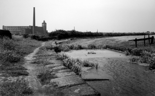
At Woodhouses the canal curves round towards Cutler Hill Bridge. On the curve is a spillway into a stream. In the background is Argyll Mill and the spire of Faislworth Church (1960s). [Photo: Leonard Kaye courtesy Oldham Local Studies Library]
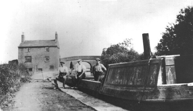
Cutler Hill Bridge and the Bay Horse pub behind the canal company maintenance boat (1950s). [Photo: Garry Jones of Littlemoss]
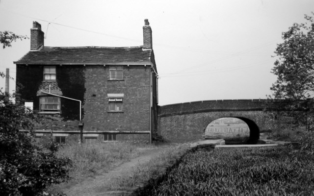
Cutler Hill Bridge and the Bay Horse pub (1960s). [Photo: Leonard Kaye courtesy Oldham Local Studies Library]
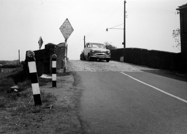
Cutler Hill Bridge (1960s). [Photo: Leonard Kaye courtesy Oldham Local Studies Library]
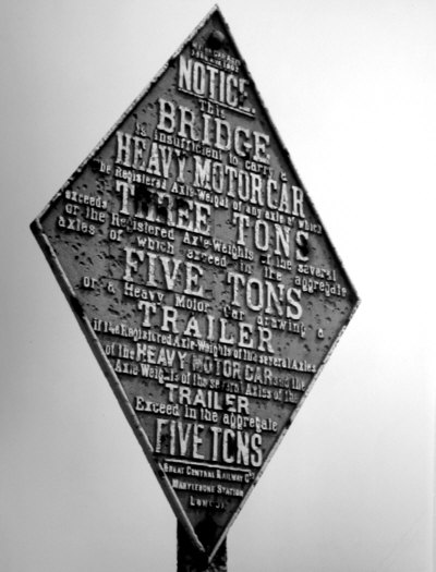
Weight restriction sign at Cutler Hill Bridge (1960s). [Photo: Leonard Kaye courtesy Oldham Local Studies Library]
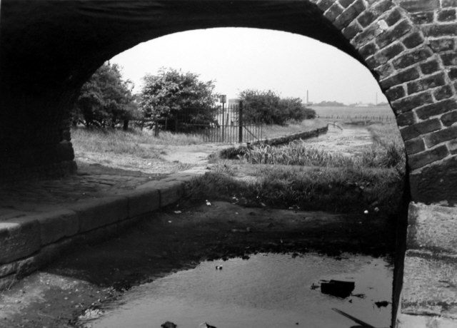
View under Cutler Hill Bridge, looking north, showing the dam to hold in water used by Mersey Mill (1960s). [Photo: Leonard Kaye courtesy Oldham Local Studies Library]
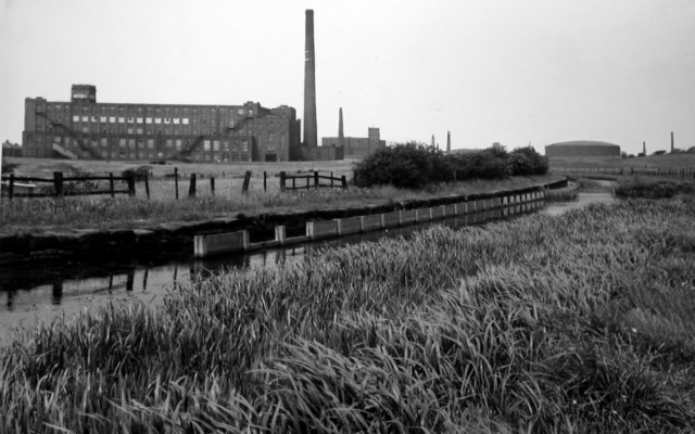
North of Cutler Hill Bridge, with Mersey Mill on the left and the large gas holder straight ahead (1960s). [Photo: Leonard Kaye courtesy Oldham Local Studies Library]
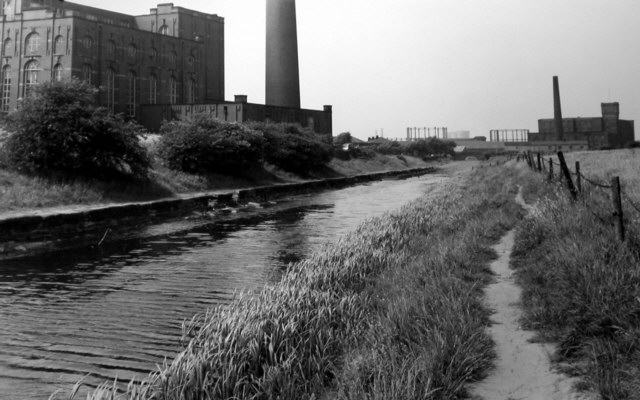
Canal near Mersey Mill looking towards Street Bridge and Albert Mill (1960s). [Photo: Leonard Kaye courtesy Oldham Local Studies Library]
Go to next page: Street Bridge to Hollins Road
[Back to previous page - Pinch Farm and Crime Lake]
[Back to: Photo Gallery Index Page]
Photos credited to Chris K. Potter Archive: these may be freely reproduced subject to acknowledgement of "Chris K. Potter Archive" as source.
Other photos may not be reproduced without permission of the photographer or collector.
